Gen. Pinciples (DCS)
Our Training Airfields
1. Caucasus (free to play Map)
1.2. Kutaisi-Kopitnari UGKO
Height (ELEV / QNH): 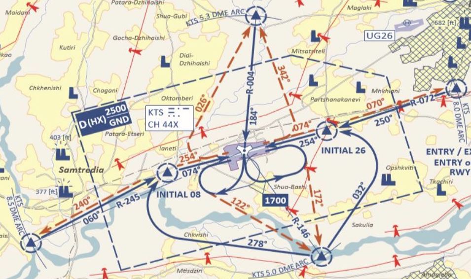
45m/148ft
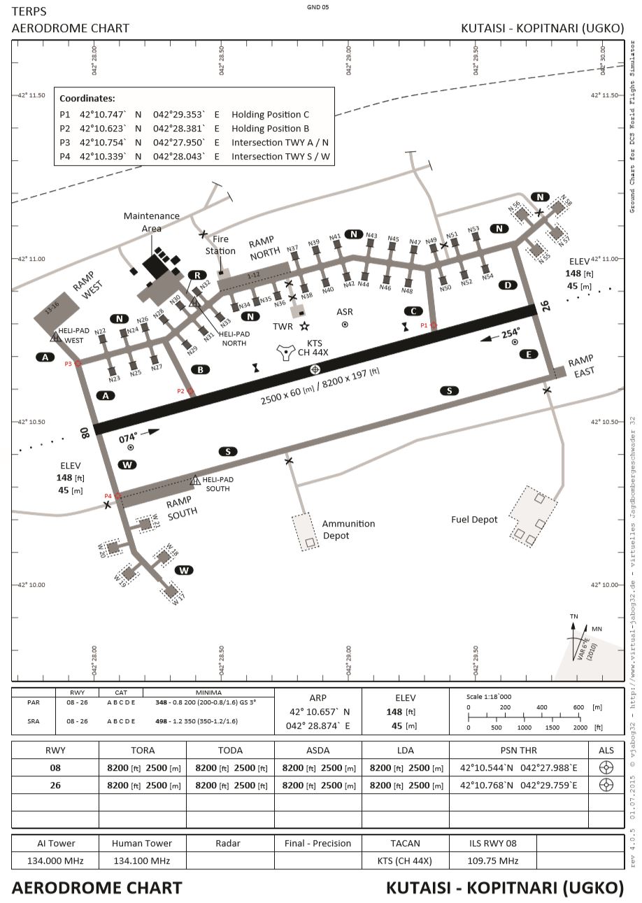
Runway:
Concrete, 2500m x 60m, (8200ft x 197ft).
Controlled Airspace:
CLASS D - Ground (0) to 2500ft
Overflight:
>2500ft
Special features:
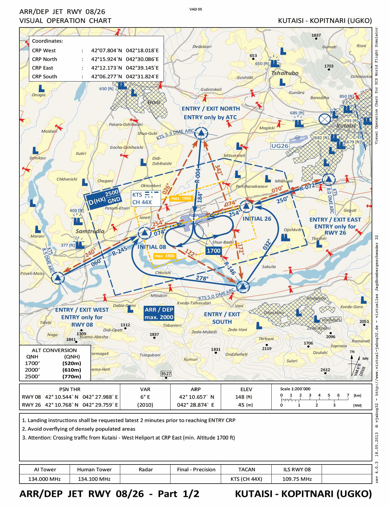
According to the Visual Operation Charts, we find specified approach paths within the OFS at Kutaisi-Kopitnari airfield.
In the immediate vicinity (7.5 Nm, 50°) is an old airfield (UG26), which is used not only for civil aviation, but also by the police and military, especially for helicopter squadrons. Here, the Echo approach route crosses the East approach route from Kopitnari. It is therefore mandatory to maintain the minimum altitude when approaching via East.
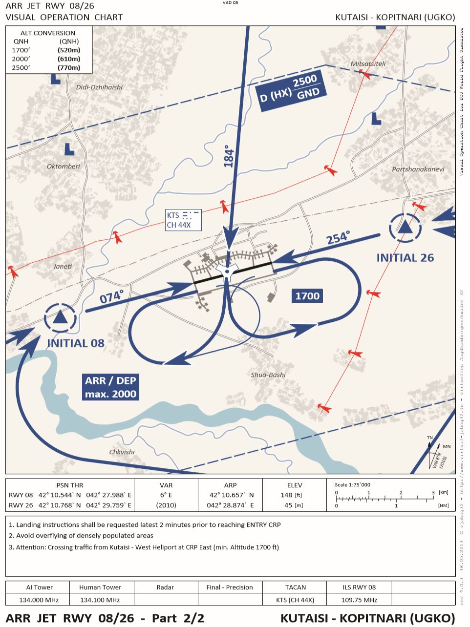
Two designated areas for aerodrome circuits with different altitude limits.
|
|
Incoming traffic (Approach) from all directions: - via Entry South to runway 08 / 26 - via Entry Point East to runway 26 (minimum altitude 1700) TACAN approach: - via Entry North R-004 Holding Pattern: - as required and cleared in the designated area Departure traffic: - Four Exit Points as shown on the chart depending on take-off direction and departure course. - For departures via Exit East, observe minimum altitude 1700.
- North with altitude restriction 1500ft - South with altitude restriction like airspace D 2500ft |
|
(click to enlarge) |
|
|
(click to enlarge) Aerodrome charts as pdf: Download |
schöner kurzer und direkter Anflug auch für Jets via TACAN |